7 Scenic Hikes That Look Harder Than They Are
Across the United States, some day hikes look intimidating in photos: crater rims, glacier basins, and towering peaks can read as expert-only terrain. On the ground, many of these routes are well-marked, maintained, and non-technical, with grades that feel steady rather than brutal. The seven picks below pair dramatic scenery with realistic mileage and elevation so most prepared hikers can enjoy a big view without a big sufferfest, especially in summer.
Emerald Lake Trail, Rocky Mountain National Park
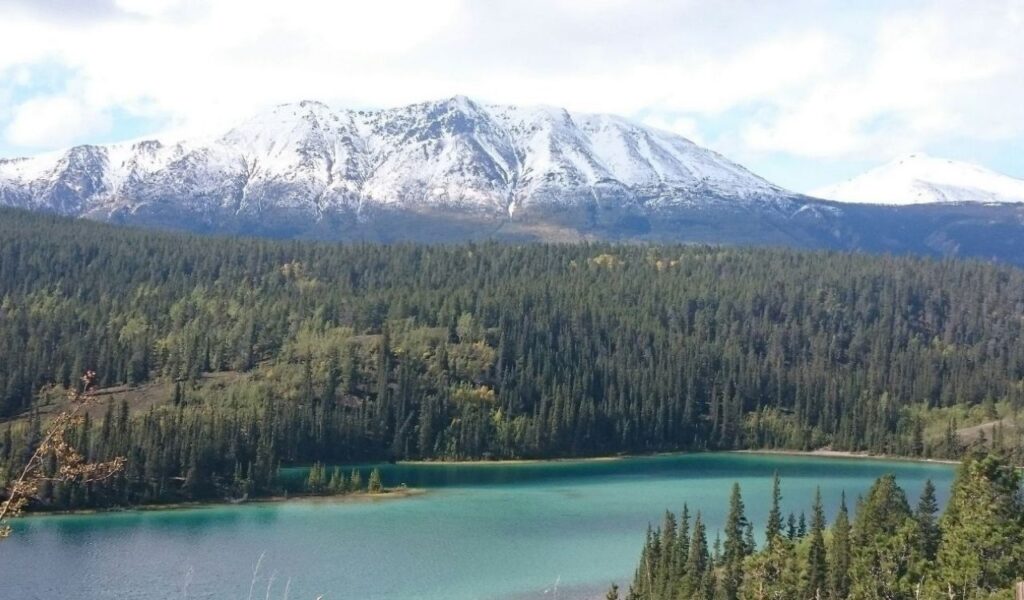
Emerald Lake looks like a high-alpine grind because Hallett Peak and Flattop Mountain loom right behind the water. The National Park Service lists the hike at 3.6 miles round trip with 771 feet of gain from Bear Lake, so the climb is steady but short. Nymph Lake and Dream Lake break up the effort and offer natural breathers. The route begins around 9,475 feet, so pacing matters more than leg strength. Most of the surface is packed dirt and rock steps, not loose scrambling. Start early for parking and to beat afternoon thunderstorms that build in the Front Range. A light jacket and extra water usually solve the rest.
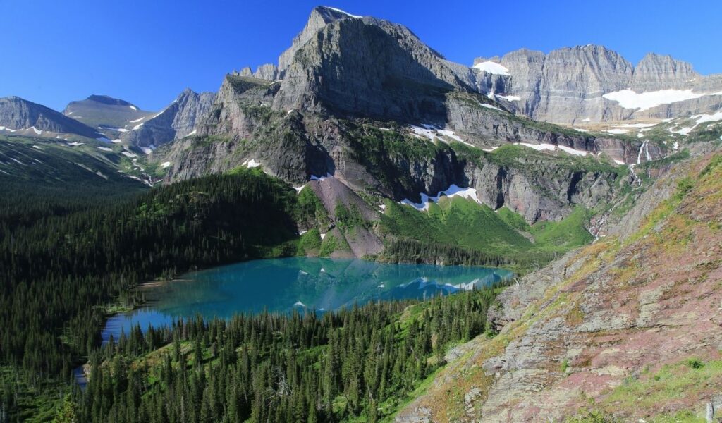
2. Avalanche Lake Trail, Glacier National Park
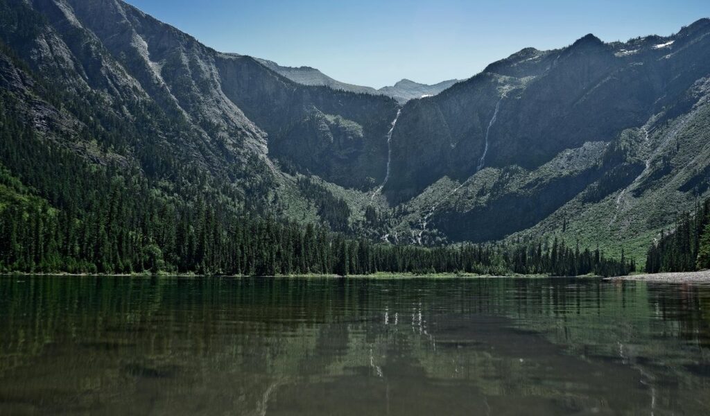
Avalanche Lake photographs like a remote alpine bowl, with waterfalls pouring off dark walls into a bright, cold lake. Glacier’s trail page lists it at 2.3 miles one way with about 500 feet of gain, so the grade stays friendly. The approach starts near the Trail of the Cedars and climbs through the forest on a clear path. Roots and small rocks keep it interesting, but there is no exposure or route-finding. This is bear country, so hike in a group and follow park safety rules. Go early because parking at Avalanche can fill fast in July and August. Turn back anytime, and you still get the forest payoff.
3. Skyline Trail, Mount Rainier National Park
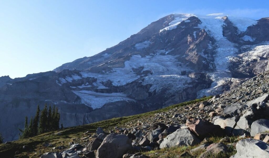
Skyline Trail at Paradise looks like a summit mission because Rainier’s glaciers dominate every frame. The National Park Service lists the loop at 5.5 miles round trip with about 1,700 feet of gain, yet the climb comes on a well-built trail with frequent junction signs. In summer, many hikers treat it as a choose-your-own route: reach Myrtle Falls, climb higher for wildflower meadows, then turn around when legs say stop. Because it starts high, the scenery arrives early, and the path does not require hands-on scrambling. Snow can linger into early summer, and clouds can roll in fast, so carry layers and check the forecast.
4. Diamond Head Summit Trail, Honolulu
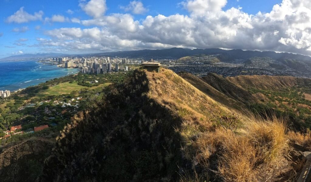
Diamond Head’s crater walls make the summit look brutal from Waikiki, especially in midday sun. Hawaii State Parks notes the route is 0.8 miles one way with a 560-foot climb, so it is steep but short. The trail was built for coastal defense access and still passes military features on the way up. A concrete walkway covers the early stretch before it turns uneven, with switchbacks, stairways, and a lighted tunnel. Railings and clear signage help, but good shoes matter on the rough tuff surface. Go early for cooler temps and bring water because shade is limited, then enjoy the sweeping Honolulu view.
5. Hidden Lake Overlook Trail, Glacier National Park
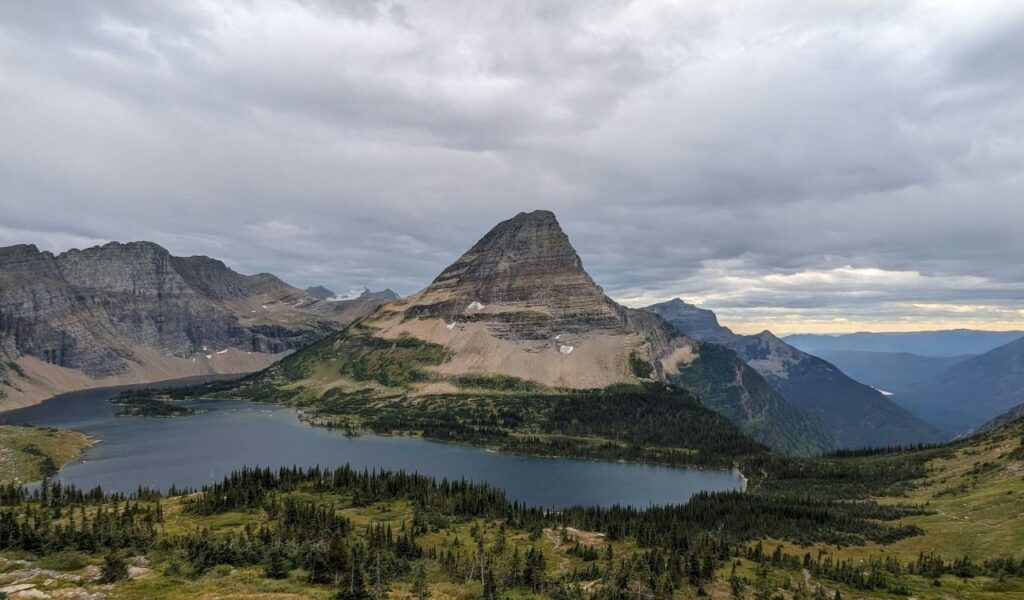
Hidden Lake Overlook looks like an expert-only alpine outing because Logan Pass sits among sharp peaks and lingering snow. The National Park Service lists the overlook at 1.3 miles one way with 608 feet of gain, but much of the route is a boardwalk built to protect fragile tundra. Stairs and switchbacks keep the grade predictable, so the climb feels structured rather than wild. Many hikers stop at the overlook instead of continuing down to the lake, which keeps the outing short. Boardwalk planks can be slick after rain, so step carefully. Arrive early for parking and watch for mountain goats near the trail.
6. Observation Point Via East Mesa Trail, Zion National Park
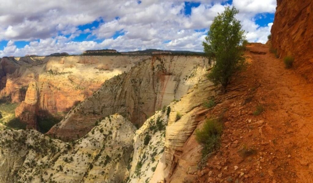
Observation Point towers above Zion Canyon and looks like a lung-buster climb from the valley floor. The East Mesa route flips that story. Trail reports commonly list about 7 miles round trip with roughly 700 feet of gain, spread out gently instead of stacked into switchbacks. The tread is wide, mostly level, and lacks the exposed chain sections that scare people off other Zion icons. The main challenge is logistics: the last miles to the trailhead can be rough when roads are wet. Once on the rail, the overlook delivers a huge view with an effort that feels steady and predictable.
7. Grinnell Lake Trail, Glacier National Park
Grinnell Lake sits under steep walls in the Many Glacier area, and the photos make it look like a hard push into serious terrain. On paper, it is surprisingly mild. The National Park Service lists the hike at 3.4 miles one way with only 60 feet of elevation gain, so most of the work is simply walking. The path rolls along Swiftcurrent and Josephine Lakes with clear tread and long sight lines. If the concession boats are running, the walk can shrink to about 1.1 miles one way after the ride. Carry bear spray and keep distance from wildlife, then enjoy the turquoise payoff. Start early.