Hiking in Cozumel: The Ultimate Guide
Are you looking for the best places to go hiking in Cozumel? You’re in the right place. I lived in Cozumel and love hiking, so I can direct you to the perfect trails.
When people think of Cozumel, they don’t often think of it as a great place to go hiking.
In fact, when I started looking for some good hikes, I was surprised to find so many options.
I’ve rounded up the best Cozumel hiking trails so you can get out and enjoy all this beautiful nature.
Overview of Hiking in Cozumel
Cozumel isn’t just about beaches and snorkeling. Believe it or not, it’s a hiker’s haven! The island offers a variety of terrains and experiences that cater to everyone, from casual strollers to trailblazing enthusiasts.
You can wander along sandy shores with views of the Caribbean Sea, explore tropical jungles, tackle rocky terrain for a more challenging hike, or take it easy on well-paved paths suitable for hikers of all ages and abilities.
There’s a lot to see while you’re out hiking. You can immerse yourself in Mayan history by walking through historical sites. Along the way, you can spot exotic birds, butterflies, and tropical plants.
You’ll also have the opportunity to discover natural sinkholes known as cenotes and historic lighthouses with panoramic views.
You’ll find short and easy trails for a gentle stroll. Or for more adventure, there are more challenging routes.
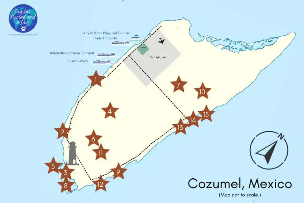
17 Best Hiking Spots in Cozumel
Here are the spots for the best hiking in Cozumel. I’ve ordered them from shortest to longest so you can easily find the best hike for you.
Note that distances and times are approximate.
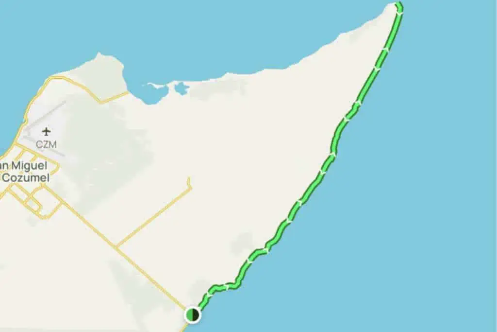
Here is a very rough map of the general locations of each hike’s starting point.
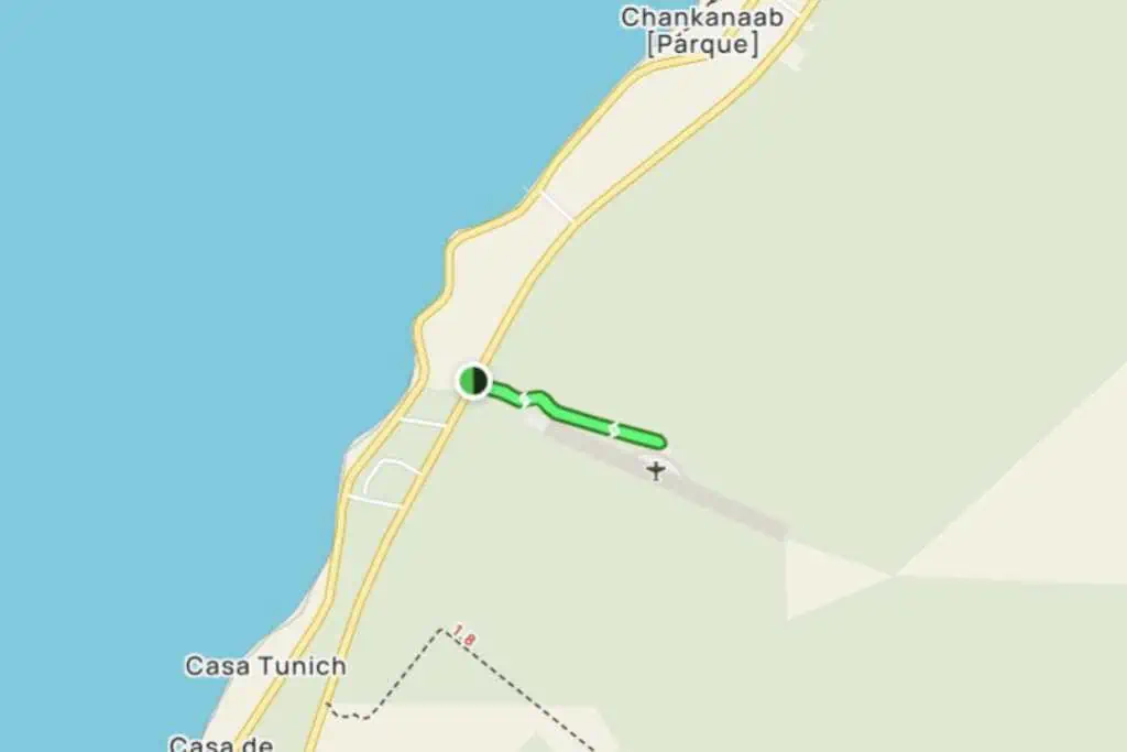
1. Chankanaab National Park
Location: About halfway down the west side (see on map)
Trail Length: 1 mile
Difficulty: Easy
Average Time: 20 minutes
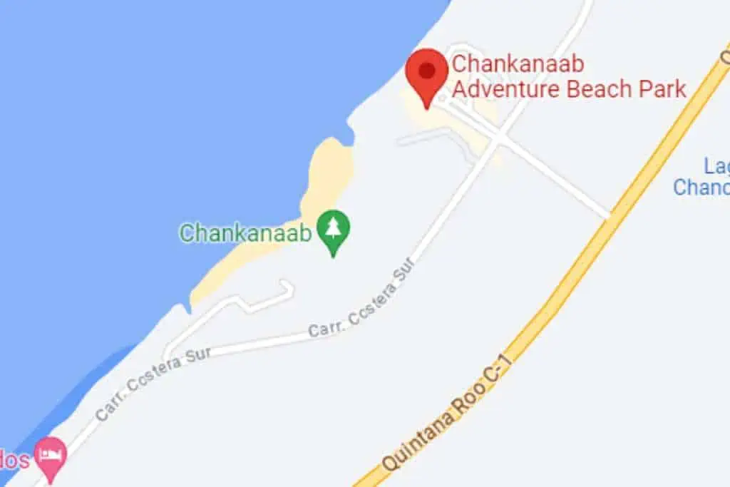
Chankanaab National Park is often celebrated for its water activities, but let’s not overlook its nature trail. The trail is a breeze with shady paved paths.
Honestly, it’s more of a nature walk than a hike. If you’re like me and hate wearing shoes, you can do this walk in your flip-flops.
If you get hungry or want to shop, on-site restaurants offer Mexican cuisine, and there are multiple gift shops for souvenirs.
The park also has a swimming pool, a zipline, tequila tasting, and even a crocodile exhibition.
It’s a popular spot for cruise ship tourists, and you can easily get there by taxi.
What to See at Chankanaab
- Tropical Plants: The trail is partially shaded by a variety of tropical plants.
- On-Site Restaurants: If you’re a foodie, the Mexican cuisine here won’t disappoint.
- Gift Shops: Perfect for picking up a memento or two.
- Additional Activities: From a swimming pool to a zipline and even a crocodile exhibition, there’s more than just hiking here.
Tips For Hiking Chankanaab
- Make it a full day: Combine this with a snorkeling trip to maximize your day.
- Entrance fee applies: Adults pay $21, and kids 3-11 are $14. (Prices subject to change.)
- Hours and admission: Open Monday-Saturday from 8:00 am to 4:00 pm. (Also subject to change.)
- Ethical considerations: The park offers dolphin swims, but think twice. There are concerns about the well-being of the dolphins kept in small pens.
Chankanaab is a touristy spot, but it’s still worth visiting. It’s especially good if you’ve got kids or people with mobility issues.
2. Playa Palancar
Location: Southern end of the west side (see on map)
Trail Length: 1.25 miles round trip
Difficulty: Easy
Average Time: 23 minutes
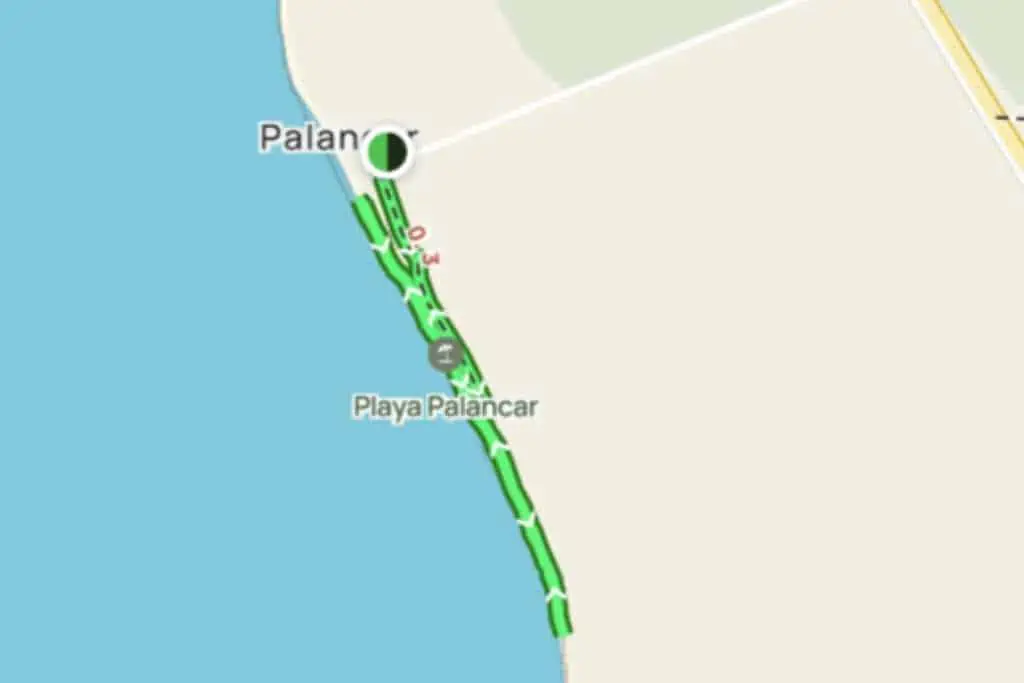
Playa Palancar is a 1.25 out-and-back trail that offers a quick and easy hiking experience. Taking an average of just 23 minutes to complete, this trail is perfect for a short run, jog, or walk.
The hike starts at Playa Palancar Beach Club, where you’ll find a restaurant and other amenities.
Head to the south and you’ll soon find yourself on a less crowded beach where you can enjoy the sand and sea.
Playa Palancar is one of the most beautiful beaches in Cozumel and my personal favorite. Be sure to wear your bathing suit because you’ll want to hop in the water.
What to See at Playa Palancar
- White Sand Beach: Perfect for a run, jog, or walk.
- Turquoise Waters: Ideal for a refreshing swim after your hike.
Tips For Hiking at Playa Palancar
- Bring sunscreen and water to stay hydrated.
- You’ll need to pay if you want to access the beach club. Your $10 entrance fee is credited towards food and drinks.
Playa Palancar never gets old. You can also head north from the beach club. The whole stretch is just stunning. It’s a bit out of town, so it’s not usually terribly crowded.
3. La Playa Mas Hermosa
Location: Southern Cozumel (see on map)
Trail Length: 1.25 miles round trip
Difficulty: Easy
Average Time: 22 minutes
La Playa Mas Hermosa (“Most Beautiful Beach”), also known as Playa Punta Sur and Playa el Cielo, is a 1.25-mile out-and-back trail that’s perfect for a quick run or walk.
The trail takes an average of 22 minutes to complete and offers a secluded experience, as it’s not usually crowded.
The beach itself is long and wide, framed by lush jungle vegetation, and offers incredible views.
The entrance is through Punta Sur Eco Beach Park, and there is an admission fee. Once inside, you’ll find food and drink services, umbrellas, and bathrooms.
What to See at La Playa Mas Hermosa
- Incredible Beach Views: The beach is long and wide, providing ample space for activities.
- Lush Jungle Vegetation: The beach is framed by beautiful greenery, adding to its charm.
Tips For Hiking La Playa Mas Hermosa
- Bring sunscreen and water, even though amenities are available.
- The trail is great for running and walking, so it’s suitable for various fitness levels.
La Playa Mas Hermosa lives up to its name as a beautiful beach destination on Cozumel. Whether you’re looking for a quick run, a leisurely walk, or just a peaceful spot to relax, this is the perfect place.
4. Aerodromo Capital Eduardo Toledo
Location: Near Cozumel’s private airfield, south of San Miguel (see on map)
Trail Length: 1.25 miles round trip
Difficulty: Easy
Average Time: 29 minutes
The Aerodromo Capital Eduardo Toledo trail is a quick 1.25-mile out-and-back route that’s perfect for a short outdoor activity.
Taking just under 30 minutes to complete, this trail is great for hiking, mountain biking, and even scenic driving.
Located near the airfield on Cozumel Island, the trail offers a lush, tropical setting that’s ideal for running, jogging, or simply enjoying a walk.
The trail itself doesn’t offer amenities like restaurants or stores, so bring any supplies you’ll need.
What to See on the Entrada Aerodromo Capital Eduardo Toledo Hike
- Thick Green Vegetation: The trail is surrounded by the lush flora of this tropical region.
- Proximity to the Beach: After your hike, you’re just a short distance from the beach where you can cool off.
Tips For Hiking Aerodromo Capital Eduardo Toledo
- This trail is great for a variety of activities, so pick your pace and enjoy.
- Don’t forget sunscreen and water, especially if you plan to hit the beach afterward.
- The trail is short, making it ideal for laps if you’re looking to get in a more intense workout.
The Aerodromo Capital Eduardo Toledo trail offers a quick and versatile outdoor experience. Whether you’re looking to get in a quick workout or just want to enjoy the tropical scenery, this trail has something for everyone.
5. Playa El Cielo
Location: Southern tip of Cozumel (see on map)
Trail Length: 1.25 miles round trip
Difficulty: Easy
Average Time: 22 minutes
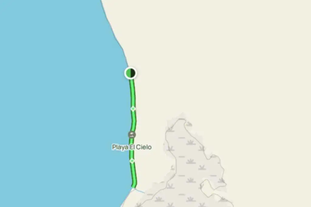
Playa El Cielo is a 1.25-mile out-and-back trail that offers a unique and remote experience.
Taking an average of just 22 minutes to complete, this trail is perfect for jogging, running, or walking.
Unlike many touristy spots on Cozumel, Playa El Cielo is accessible only by boat, making it a secluded paradise.
The beach is known for its white sand and crystal-clear turquoise waters, but its real claim to fame is the colorful starfish visible below the surface.
Don’t pick up the starfish or touch them at all. It harms them and isn’t worth the photo.
Since the beach is remote and accessible only by boat, there are no amenities like restaurants or stores. You’ll need to bring all your supplies.
What to See at Playa El Cielo
- Colorful Starfish: The highlight of this beach, visible just below the water’s surface.
- White Sand Beach: Ideal for a run, jog, or walk.
- Turquoise Waters: Perfect for a refreshing swim or paddle sports.
Tips For Hiking at Playa El Cielo
- Access the beach by boat or catamaran from Chankanaab Park, Laguna de Colombia Pier, or Playa Palancar.
- Bring sunscreen and water to stay hydrated.
- Don’t forget your camera to capture the colorful starfish and beautiful scenery.
The water near El Cielo gets busy with boats and snorkelers. However, few people go to the beach. It’s worth the effort to get there for the amazing views.
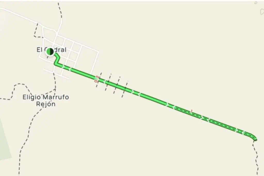
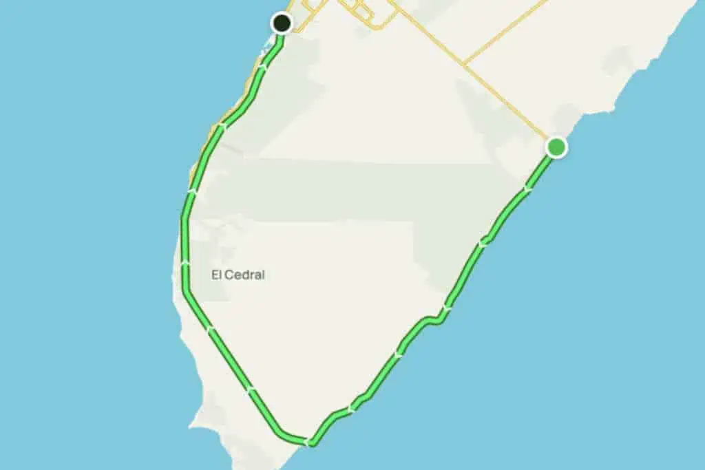
6. El Cedral
Location: Southern Cozumel
Trail Length: 2.5 miles
Difficulty: Moderate
Average Time: 1 hour
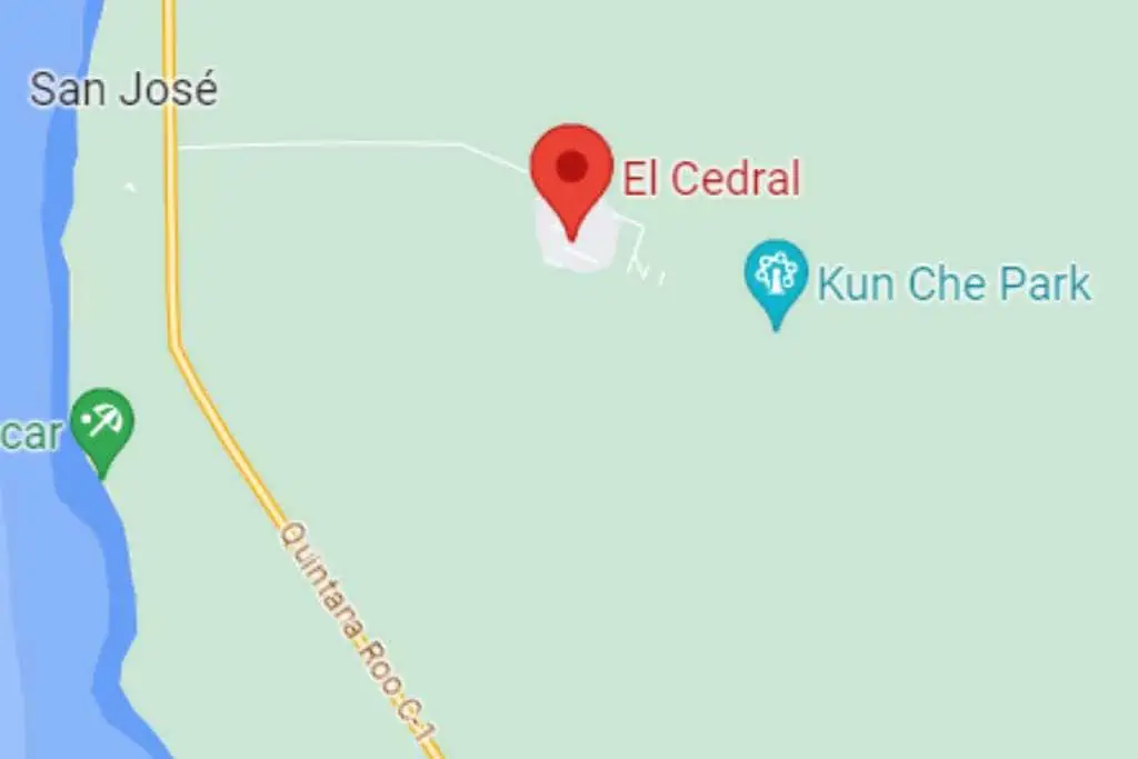
El Cedral is more than just a trail; it’s a journey through a small Mayan village surrounded by dense jungle.
The 2.5-mile trail is moderately difficult, featuring uneven and rocky paths.
The area is mostly shady, providing a nice break from the sun. The village itself has local eateries and small shops where you can pick up basic supplies.
What to See at El Cedral
- Dense Jungle: The trail takes you through a lush, dense jungle, offering a unique hiking experience.
- Local Eateries and Shops: Experience the local culture by stopping at one of the village’s eateries or shops.
- Jade Cavern: If you’re up for more adventure, there’s a trail in the jungle that leads to this natural sinkhole. More on that hike later.
Tips For Hiking at El Cedral
- Bug spray is essential; the dense jungle is home to various insects, especially mosquitoes.
- Respect the local community and their land while you explore.
El Cedral offers a unique hiking experience that combines natural beauty with cultural richness.
The town itself is charming and fun to walk through. You’ll be amazed at how quiet it is.
7. San Gervasio Ruins
Location: Near Cozumel Island, Quintana Roo
Trail Length: 3 miles round trip
Difficulty: Easy
Average Time: 1 hour
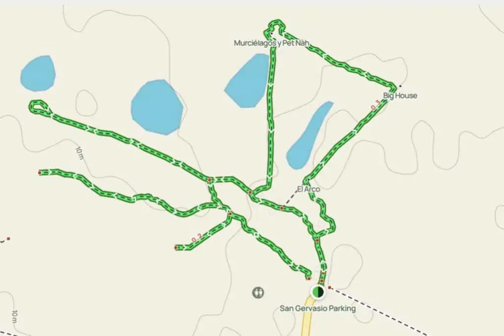
The San Gervasio Ruins offers a variety of hiking options. The most popular is a 3-mile out-and-back trail that offers a unique blend of natural beauty and historical significance.
Taking just over an hour to complete, this trail is perfect for a leisurely walk.
The San Gervasio Archaeological Zone is a temple dedicated to the Mayan goddess Ixchel and was an important center of commerce and political development. For a small entrance fee, you can learn a lot about the history of the region.
What to See at San Gervasio
- Mayan Ruins: Explore the temple dedicated to the goddess Ixchel and other historical sites.
- Iridescent Blue Morphos Butterflies: Along with other butterfly species, these beauties are a sight to behold.
- Unmaintained Trails: Experience the raw, untamed beauty of the island, but exercise caution as the trails are not well-maintained
Tips For Hiking at San Gervasio
- Wear long pants and a long-sleeved shirt to protect against rashes from plants and insect bites.
- Bring bug repellent and plenty of water.
- The trails are not maintained, so exercise caution and don’t touch anything.
The San Gervasio Ruins Hike offers a unique opportunity to explore both the natural and historical aspects of Cozumel Island.
Since San Gervasio is one of the things Cozumel is known for, it’s definitely worth visiting the ruins at least once on your trip.
8. Punta Sur Eco Beach Park
Location: Southern tip of Cozumel (see on map)
Trail Length: 3 miles
Difficulty: Moderate
Average Time: 1 hour
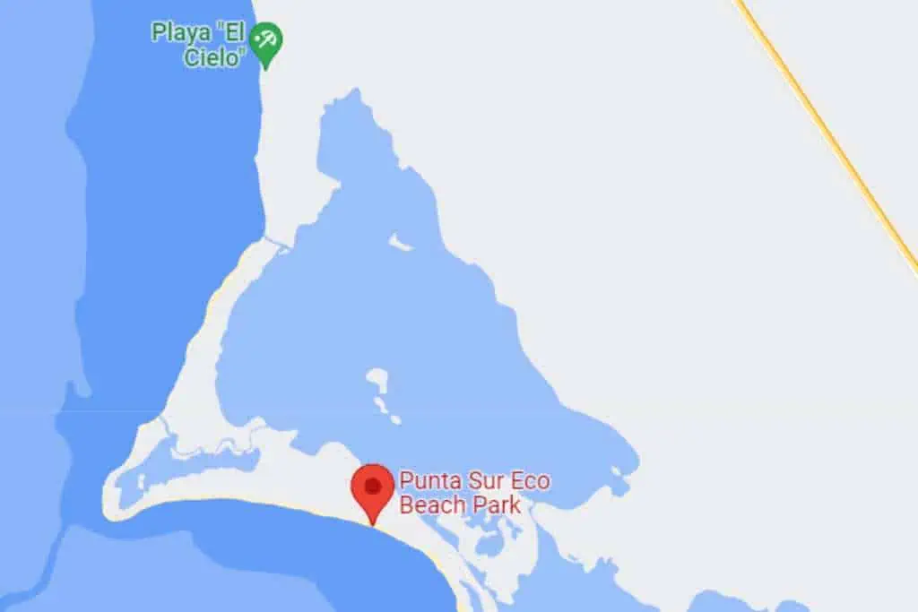
Punta Sur Eco Beach Park is a haven for those looking to experience a diverse ecosystem.
The 3-mile trail is of moderate difficulty and combines sandy trails with rocky paths. You’ll be mostly under the sun, so sunscreen is a must.
The park does offer some sparse vegetation that provides occasional shade. Near the entrance, you’ll find a small café for a quick bite and a gift shop for souvenirs.
What to See at Punta Sur Eco Beach Park
- Diverse Ecosystem: From sandy trails to rocky paths, the park offers a variety of terrains.
- Cenote at Punta Sur: There’s a trail leading from the beach to this natural sinkhole, adding an extra layer of adventure to your hike.
- Punta Sur Lighthouse: Don’t miss the opportunity to climb this lighthouse for panoramic views of the surrounding area.
Tips for Hiking Punta Sur Eco Beach Park
- Bring water and sunscreen, as you’ll be mostly under the sun.
- The park has an entrance fee, so bring cash.
Punta Sur Eco Beach Park offers a unique hiking experience with its diverse ecosystem.
Plan for extra time to stay at the park, as there is a lot to do. Plus, this part of the island has beautiful beaches that you may never want to leave.
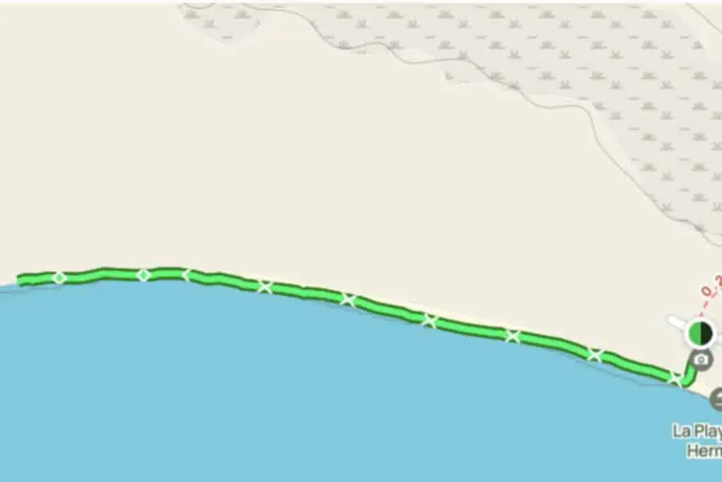
9. Cerro Chumul to Punta Morena
Location: Cozumel’s east side (see on map)
Trail Length: 3 miles round trip
Difficulty: Easy
Average Time: 1 hour
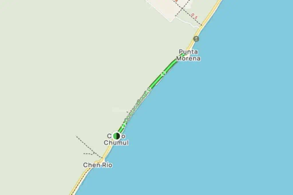
The Cerro Chumul to Punta Morena trail is a 3-mile out-and-back route that’s perfect for a quick outdoor activity.
Taking just an hour to complete, this trail is popular for road biking, running, and walking.
Despite its popularity, you can still find some solitude during quieter times. The trail follows a paved walkway along the highway on the coast, offering various scenic spots to enjoy.
What to See on the Cerro Chumul to Punta Morena Hike
- Chumul Viewpoint: A great spot for selfies and panoramic views.
- Sandy Beaches: Perfect for a quick dip or just to relax and enjoy the view.
- Marine Life: Keep an eye out for opportunities to observe sea creatures.
Tips For Hiking Cerro Chumul to Punta Morena
- This trail is great for a variety of activities, so pick your pace and enjoy.
- Take cash, as few places on the east side take credit cards.
- The trail is paved, making it accessible for road bikes as well.
The east side of Cozumel is particularly wonderful because it’s so wild. You can find long stretches of empty beaches.
10. Villa Maya Nature Preserve
Location: Center of Cozumel (see on map)
Trail Length: 3 to 6 miles
Difficulty: Easy
Average Time: 1 to 2 hours
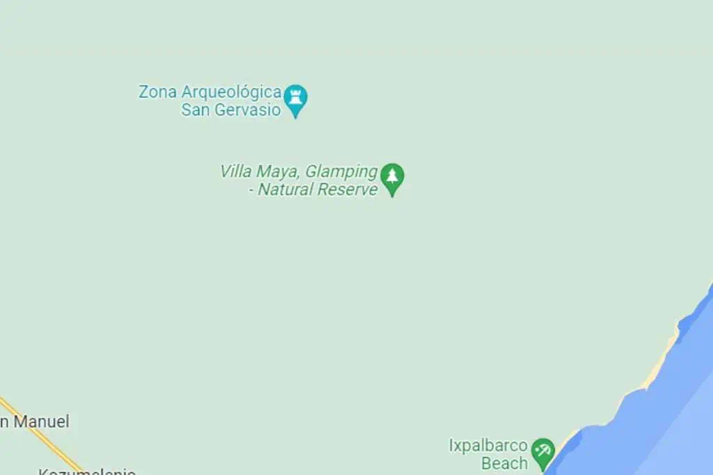
Nestled in the heart of Cozumel, Villa Maya Nature Preserve is full of natural beauty and historical significance.
The trails here are clear and well-maintained, making it an easy hike suitable for families.
As you wander through the preserve, you’ll encounter local wildlife, beautiful orchids, and bromeliads.
The area is rich in geological history and features remnants of Mayan civilization. The trails are shaded, thanks to the tropical forest canopy, offering a respite from the sun.
What to See at Villa Maya Nature Preserve
- Local Flora and Fauna: Keep an eye out for unique plant species and wildlife.
- Mayan Vestiges: Discover how the ancient Mayans lived as you come across historical remnants.
- Geological Wonders: The area’s geological history is on full display.
Tips For Hiking Villa Maya Nature Preserve
- The hike can be tailored to your fitness level, ranging from 3 to 6 miles.
- Birdwatching and wildlife spotting are popular activities here, so bring binoculars if you have them.
- Since the trails are shaded, you might not need as much sunscreen, but insect repellent is a good idea.
Villa Maya Nature Preserve offers a hiking experience that’s both educational and enjoyable.
It’s a great option for families or anyone interested in learning about Cozumel’s natural and historical treasures.
11. Jade Cavern
Location: Near El Cedral (see on map)
Trail Length: 3.5 miles round trip
Difficulty: Easy
Average Time: 1.5 hours
Cenote Chempita, also known as the Jade Cavern, is a 3.5-mile out-and-back trail located near the town of El Cedral on Cozumel Island.
This trail is an easy route that takes an average of about 1.5 hours to complete. It’s a great spot for a quick run or a leisurely walk, and you’re unlikely to run into many people.
The trail leads to an underground lake in the middle of the jungle. The path to get there is short, straight, flat, and well-shaded by lush vegetation.
There’s a small fee to visit Jade Cavern. Other than that, there are no amenities like restaurants or stores, so bring any supplies you’ll need.
What to See at Jade Cavern
- Jade Cavern: The trail culminates at this magical underground lake.
- Lush Vegetation: The path is shaded by a variety of plants, making for a pleasant hike.
Tips For Hiking Jade Cavern
- Pack water and maybe some light snacks.
- The trail is well-shaded, but sunscreen is always a good idea.
- Suitable for running and walking if you’re looking for a less strenuous activity.
Jade Cavern is a must-see in Cozumel. Hiking to it provides the best experience, but you can also catch an ATV or Jeep tour to the site.
12. Bosh Beach to Celarian Lighthouse
Location: Southern end of the east side of Cozumel (see on map)
Trail Length: 5 miles round trip
Difficulty: Easy
Average Time: 1 hour, 40 minutes
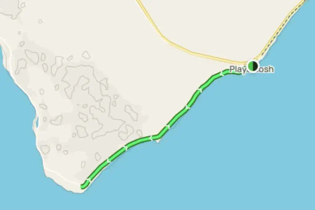
The trail from Bosh Beach to Celarain Lighthouse is a 5-mile out-and-back route that offers a variety of experiences.
The trail is considered easy and takes an average of about 1.5 hours to complete.
Starting at Playa Bosh, the southernmost point on the eastern coast of Cozumel accessible by paved roads, the trail continues on a dirt road sandwiched between the beach and the jungle.
The trail itself doesn’t offer amenities like restaurants or stores, so it’s essential to bring all the supplies you’ll need.
What to See on the Bosh Beach to Celarian Lighthouse Hike
- Sea Turtle Nesting Area: Keep an eye out for this conservation area along the route. Be careful not to disturb any nests.
- Lookout Tower: A great spot for panoramic views.
- Laguna Colombia: A picturesque lagoon that’s worth a stop.
- Celarain Lighthouse: The trail ends at this historic lighthouse, which you can climb for incredible views.
Tips For Hiking Bosh Beach to Celarian Lighthouse
- Pack plenty of water and snacks for the journey.
- Wear sturdy hiking boots suitable for both paved and dirt roads.
- Sun protection is crucial; bring sunscreen, a hat, and sunglasses.
- The trail is also suitable for mountain biking and scenic driving.
Bosh Beach is close to Rasta Bar, a great place to grab some lunch or drinks after your hike. Try their peanut butter tequila – it’s surprisingly delicious!
13. Mezcalito to Playa Ixpalbarco
Location: North end of the east side of Cozumel (see on map)
Trail Length: 6.75 miles round trip
Difficulty: Difficult
Average Time: 2 hours, 20 minutes
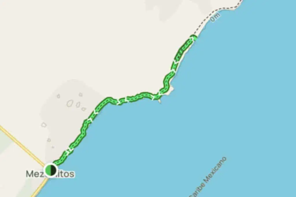
The trail from Mezcalito to Playa Ixpalbarco is a 6.75-mile out-and-back route that offers a challenging and secluded hiking experience.
Taking an average of about 2.5 hours to complete, this trail is also suitable for mountain biking and off-road driving.
The beach at Playa Ixpalbarco is beautiful but remote, with no services available. The ocean is very open at this location, so be prepared for strong waves.
There are no amenities like restaurants or stores, so be sure to bring all the supplies you’ll need.
What to See on the Mezcalito to Playa Ixpalbarco Hike
- Secluded Beach: Playa Ixpalbarco offers a quiet and remote beach experience.
- Strong Waves: The ocean is very open here, making for some impressive wave action. It’s not safe for swimming due to riptides.
- Rough Terrain: The trail itself is quite rugged, adding a bit of adventure to your hike.
Tips For Hiking Mezcalito to Playa Ixpalbarco
- Pack plenty of food, drinks, and other essentials, as there are no services available.
- The trail is rough, so wear sturdy hiking boots or consider a mountain bike or off-road vehicle.
- Be cautious of the strong waves if you plan to swim.
At the beginning of the route is a restaurant called Mezcalito’s Last Frontier. It’s a bit touristy, but a good place for lunch or drinks.
14. Mescalitos to El Castillo
Location: North end of the east side of Cozumel (see on map)
Trail Length: 10 miles round trip
Difficulty: Very Challenging
Average Time: 5 hours

If you’re up for a real adventure, the hike from Mescalitos to El Castillo is a must-try.
Starting where the road from Mezcalitos turns back to town, you’ll embark on a primitive dirt and rock road that’s not for the faint of heart.
The terrain is a mix of deep sand, boulders, and rocky paths. The area is largely exposed, so you’ll be under the sun for most of the hike.
The trail ends at Hanan Beach, which is a little more than 3.75 miles from Mezcalitos. From there, you can opt to hike an additional 1.25 miles to El Castillo, a virtually unseen Mayan temple.
This trail is off the beaten path, so don’t expect restaurants or stores. You’re in for a raw experience, which is part of the appeal.
What to See on the Mezcalitos to El Castillo Hike
- Small Mayan Building: At around 2 miles, you’ll find a small Mayan structure.
- Army Outpost: At about 2.5 miles, there’s an army outpost. They generally won’t bother you unless they suspect illegal activity.
- Hanan Beach: A pristine beach perfect for snorkeling. The fringing reef is home to unique coral formations and a sunken galleon.
- El Castillo: A hidden Mayan temple that rivals anything you’d see at Tulum.
Tips For Hiking Mezcalitos to El Castillo
- Wear sturdy hiking boots.
- Take plenty of water, insect repellent, and sunscreen.
- The hike to El Castillo is challenging. You’ll have to navigate a rough and rocky beach, dense jungle, or potentially crocodile-infested swamps.
- Be back before dusk or you’ll be eaten up by the mosquitoes.
The hike from Mezcalitos to El Castillo is not your average day trip. It’s a challenging but rewarding experience that offers a mix of history, nature, and adventure.
This is beyond my abilities, but I’ve talked to people who said it’s worth the effort.

15. Playa Bosh to Playa Mas Hermosa
Location: Southern end of the east side of Cozumel (see on map)
Trail Length: 10 miles round trip
Difficulty: Moderate
Average Time: 3 hours, 20 minutes
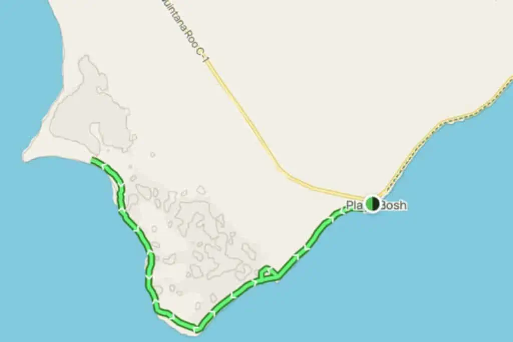
The trail from Playa Bosh to Playa Mas Hermosa is a 10-mile out-and-back route that offers a moderate and serene hiking experience.
Taking an average of just over 3 hours to complete, this trail is perfect for those looking to spend a good chunk of their day exploring.
Starting at Playa Bosh, the trail takes you past a sea turtle nesting area and the historic Farro Celarain building.
You’ll round the South Point of the island, offering unforgettable views of the turquoise water, before arriving at Playa Mas Hermosa.
The trail itself doesn’t offer amenities like restaurants or stores, so be sure to bring all the supplies you’ll need.
What to See on the Playa Bosh to Playa Mas Hermosa Hike
- Sea Turtle Nesting Area: A conservation area you’ll pass along the way.
- Farro Celarain: A historic building worth a quick exploration.
- South Point Views: Unforgettable vistas of the turquoise water.
- Playa Mas Hermosa: The trail ends at this aptly named “Most Beautiful Beach.”
Tips For Hiking Playa Bosh to Playa Mas Hermosa
- Pack plenty of water and snacks, especially since it’s a longer hike.
- Sun protection is a must; don’t forget sunscreen, a hat, and sunglasses.
- Take some time to explore Farro Celarain if you’re interested in history.
The Playa Bosh to Playa Mas Hermosa trail offers a longer hiking experience that combines natural beauty with historical landmarks. The views on this hike are just spectacular.
16. Ruta Escenica
Location: Around the entire south end of the island
Trail Length: 27 miles point-to-point
Difficulty: Moderate
Average Time: 12 hours
The Ruta Escenica is a 27-mile trail that runs parallel to the sea along the Cozumel highway. While it’s a popular route for road biking and scenic driving, hikers can still enjoy it.
You can basically start anywhere on the island and follow the main road that makes a loop. Since it’s so long, most hikers will take a taxi to their preferred starting point and hike back to town.
Note that Cozumel doesn’t have Uber. If you want to be picked up outside of town, make arrangements with a taxi driver in advance.
The best views are on the west, south, and east sides of the island. The route through the center, going back into town, isn’t very scenic. Although this is where you can find San Gervasio ruins.
The trail is mostly exposed, offering little to no shade, so sun protection is crucial. It’s recommended to start early to catch the sunrise and avoid high temperatures.
What to See on Ruta Escenica
- Photographic Viewpoints: Playa Chumul, Chen Río, and San Martín offer stunning views.
- Mirador Public Beach: A great spot to relax and take in the scenery.
- Kapliczka: A point of interest worth checking out.
- Adventure Parks: Cozumel ATV Park, Chankanaab Beach Adventure Park, and Awesome Flight Adventure Ziplines.
- Caleta Harbor: A picturesque harbor along the route.
- Discover Mexico Park Cozumel: A cultural park showcasing Mexican heritage.
There are fantastic restaurants along the way, but note that most don’t open until after 8:30 a.m. You’ll also find places to get drinks, but it’s a good idea to bring your own water and snacks.
Tips For Hiking Ruta Escenica
- Start before sunrise to catch the entire spectacle at the beach.
- You can access ruins along Tranversal de Cozumel, but they don’t open until 9 a.m.
- Wear a hat and sunglasses for sun protection.
- Cars and motorcycles may occasionally use the bike path, but they generally drive slowly and aren’t a bother.
The Ruta Escenica is an ambitious hike, but you can make it as long as you want.
If you choose only part of it, I’d skip the strip down the center. The views just aren’t great there. You’re basically just walking down the highway.
17. Mezcalitos to Punta Molas
Location: North end of the east side of Cozumel (see on map)
Trail Length: 30 miles round trip
Difficulty: Difficult
Average Time: 13 hours
The Mezcalitos to Punta Molas trail is a 30-mile out-and-back route that takes you from the last accessible point by car on the eastern coast of Cozumel to its northernmost tip.
This trail is perfect if you’re looking for a more secluded experience, as it’s unlikely you’ll encounter many people. The route is considered difficult and takes an average of around 10.5 hours to complete.
You’ll be hiking along the beach, offering stunning views of the Caribbean Sea. The trail culminates at Punta Molas, where you’ll find a historic lighthouse.
This is a remote trail, so there are no amenities like restaurants or stores along the way. It’s essential to bring all the supplies you’ll need.
What to See on the Mezcalitos to Punta Molas Hike
- Caribbean Sea Views: The trail runs parallel to the beach, offering uninterrupted views of the Caribbean Sea.
- Punta Molas Lighthouse: A historic lighthouse at the northernmost point of the island.
Tips For Hiking Mezcalitos to Punta Molas
- Pack plenty of water and snacks for the journey.
- Wear sturdy hiking boots suitable for sandy and rocky terrain.
- Sun protection is crucial; bring sunscreen, a hat, and sunglasses.
- This trail is also suitable for mountain biking and backpacking if you’re looking for a different kind of adventure.
With its stunning beachside views and the historic Punta Molas lighthouse as your endpoint, this trail provides a fulfilling sense of accomplishment.
Again, this is beyond my abilities, so I haven’t made this hike myself. But from what I hear, it’s amazing.

Recommended Equipment for Hiking in Cozumel
When it comes to hiking in Cozumel, being prepared can make all the difference. Here’s a rundown of the gear you should consider packing for your adventure.
- Hiking Boots or Trail Runners: The terrain can vary from sandy beaches to rocky paths. A good pair of hiking boots or trail runners will provide the support and grip you need.
- Quick-Dry Clothing: Cozumel can get hot and humid. Opt for moisture-wicking and quick-drying fabrics.
- Hat and Sunglasses: Protect yourself from the sun, especially on trails with little shade.
- Backpack: A small to medium-sized backpack should suffice for day hikes.
- Water Bottle or Hydration System: Staying hydrated is crucial. Consider a hydration bladder for longer hikes.
- Sunscreen: SPF 30 or higher is recommended. Opt for reef-safe sunscreen if you plan on swimming.
- Insect Repellent: Mosquitoes can be a nuisance, especially in wooded areas. Cozumel has had many cases of Dengue fever lately, so don’t skimp on the repellent!
- GPS or Smartphone: Useful for tracking your route, but remember, you might not always have service. Consider getting a Mexican SIM card for your phone to improve the chances of getting reception.
- Energy Bars and Fruit: Quick and easy snacks like energy bars or fruit can keep you fueled.
- First-Aid Kit: Basic supplies can treat minor injuries.
- Multi-tool: You never know when you might need to cut something or make a quick repair.
- Camera: For capturing the stunning scenery, of course!
Remember, the type and amount of equipment you’ll need can vary depending on the length and difficulty of the hike.
For more casual hikes, you’ll probably be fine with a good pair of sneakers or Tevas. For some of the more strenuous and rocky hikes, good boots will be your best friend.
Frequently Asked Questions: Hiking in Cozumel
Do I need a guide to hike in Cozumel?
While some trails are well-marked and easy to navigate, a guide can offer valuable insights, especially on trails with historical or ecological significance. However, a guide isn’t strictly necessary for most trails.
What should I pack for a hike in Cozumel?
Essentials include water, sunscreen, bug spray, and a hat. If you’re planning a longer hike, consider packing snacks and a first-aid kit as well.
Are the trails in Cozumel family-friendly?
Many trails in Cozumel are suitable for families and offer shorter routes for those hiking with kids. Trails like those in Chankanaab National Park are quite accessible.
Can I combine Cozumel hiking with other activities?
Absolutely. Many trails are near beaches, cenotes, or snorkeling spots. For example, you can hike and snorkel at Punta Sur Eco Beach Park.
Do I have to pay to hike?
Some trails are free, but others, especially those in national parks or archaeological sites, may have an entrance fee. Always carry some cash just in case.
Is it safe to hike alone in Cozumel?
While many trails are safe, it’s always a good idea to let someone know your plans and estimated return time. Some trails are remote and may not have cell service.
What’s the best time of year to hike in Cozumel?
The dry season from November to April is generally the best time to hike, as you’ll avoid the heavy rains and high humidity of the wet season.
Wrap-Up: Hiking in Cozumel
Cozumel might be famous for its crystal-clear waters and marine life, but its hiking trails are an underrated treasure.
Whether you’re an experienced hiker looking for a challenge or a family seeking a leisurely stroll, Cozumel has a trail for you. From the dense jungles of El Cedral to the scenic vistas of Punta Sur Eco Beach Park, each trail offers a unique experience.
So, next time you find yourself in Cozumel, don’t just stick to the water. Lace up those hiking boots, pack some water and snacks, and hit the trails. Hiking in Cozumel is an activity you won’t forget.
Related Posts
- Cozumel Crocodiles – What You Need to Know
- Best Places For Ziplining in Cozumel
- What is Cozumel Known For?
- Is There Uber in Cozumel?
- Jeep Tours in Cozumel
- Is Cozumel Worth Visiting?
- Best Free Beaches in Cozumel
- Guide to Grocery Stores in Cozumel, Mexico
- Cozumel Pronunciation – How to Sound Like a Local
- Cozumel Diving: The Complete Guide
- Inside the Cozumel National Marine Park
Pro Tips for Your Mexico Trips
Do I need travel insurance?
YES. No matter when you visit Mexico, don’t forget to buy travel insurance. It’s a small price to pay for peace of mind. If you need it once it will pay for itself many times over. I highly recommend Safety Wing. They have a proven track record for customer satisfaction and a variety of coverage levels.
Is it safe to rent a car in Mexico?
YES. Renting a car in Mexico is not only safe, but it’s a great way to explore. Discover Cars is hands down the best rental car company. They check international and local companies to get you the best rates.
Will my phone work in Mexico?
Maybe — It depends on your company, so check with your provider. If you don’t have free service in Mexico, the least expensive option is to buy a Telcel SIM card. As Mexico’s largest carrier, Telcel has the best coverage of any Mexico SIM Cards. I have one and it’s been a lifesaver.
You can also get an eSIM. Airalo has coverage in over 200 countries/regions, including Mexico.
What’s the best way to book my Mexico accommodations?
For Mexico hotels, Booking.com is the best site, but for hostels, check out Hostel World. If you’re considering a Mexico Airbnb, don’t forget to check VRBO, which is often cheaper with more options.
What do I pack for Mexico?
My Mexico packing list has all the info you need on packing for your trip to Mexico.
What’s the best site for great deals on flights to Mexico?
For finding cheap Mexico flights, I recommend using Skyscanner.
Do I need a visa for Mexico?
Probably Not. U.S., Canadian, and most European passport holders don’t need a visa for Mexico. To verify if you’ll need a Mexico travel visa check the Mexican Consulate’s website.
For assistance with all your worldwide visa questions, check out iVisa.