Ready to Hike? Not Until You See These 6 Must-Experience Mountain Trails in the U.S.
Permits, altitude, and seasonal access can make or break a U.S. mountain hike. Half Dome requires a Half Dome permit to use the subdome steps and cables when they’re up, and Zion requires a permit for the Angels Landing chains. Colorado’s Four Pass Loop adds overnight permit zones and bear-canister rules, while Mount Washington is known for rapid weather shifts above treeline. These six picks focus on what hikers actually face on the ground: mileage, gain, rules, and timing.
1. Half Dome Trail In Yosemite National Park
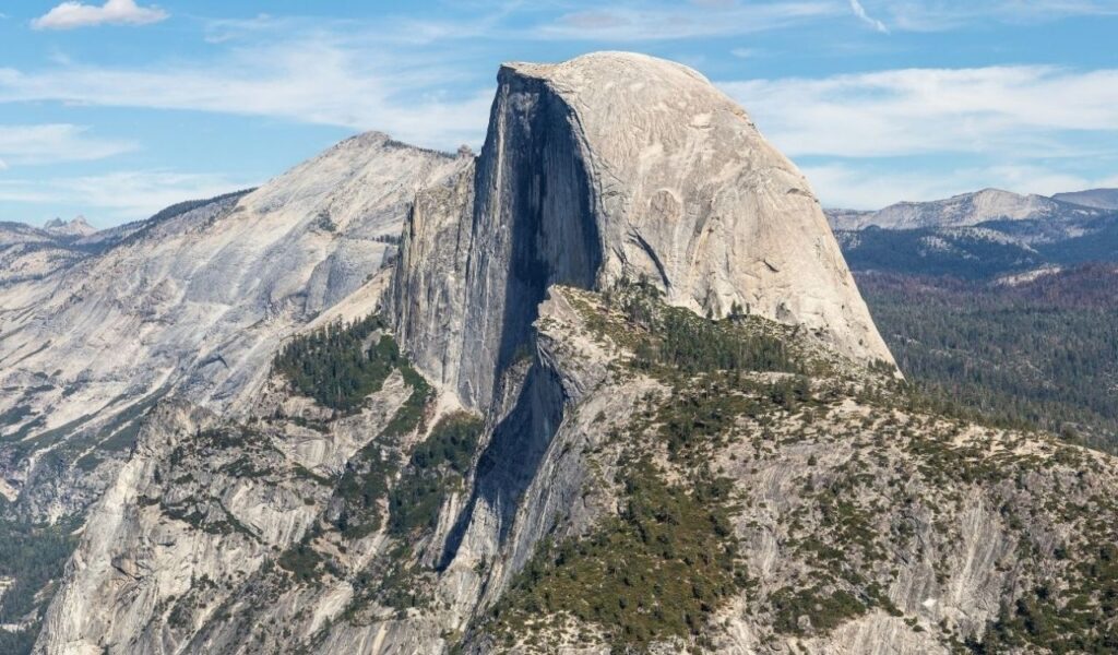
Half Dome is a 14–16 mile round trip with about 4,800 feet of elevation gain, most often reached via the Mist Trail past Vernal and Nevada Falls. When the cables are installed, you must have a Half Dome permit to climb the subdome steps and ascend the cables, and day-hiker permits are issued by lottery on Recreation.gov. Plan a pre-dawn start, carry 3–4 liters of water in summer heat, use gloves on the cable handrails, and keep patient spacing on the steepest stretch. Snowmelt and storms can shift conditions, so check current trail notices before you commit, including cable status.
2. Angels Landing In Zion National Park
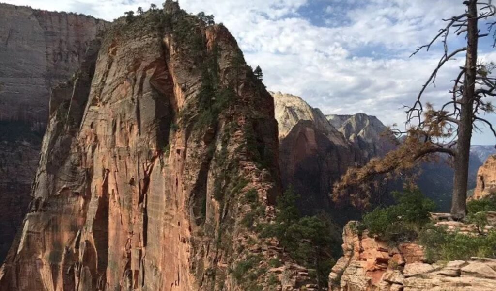
Angels Landing runs about 5.4 miles round trip: hikers climb the West Rim Trail to Scout Lookout, then tackle the final half mile on the chains. NPS requires a permit for the chains section and warns that many deadly accidents since 1930 have occurred there, so skip it in rain, ice, or high wind and keep one hand free for balance. Start early to avoid heat, follow shuttle rules at The Grotto trailhead when shuttles are running, and wear shoes with solid tread. If you do not get a permit, the hike to Scout Lookout still climbs about 1,000 feet and delivers wide Zion Canyon views without the knife-edge ridge.
3. Mount Washington Via Tuckerman Ravine Trail
Mount Washington via Tuckerman Ravine is commonly hiked as an 8.4-mile out-and-back with roughly 4,250 feet of elevation gain from Pinkham Notch. The upper mountain is fully exposed and famous for abrupt weather, so pack insulating layers and a shell even in July, then check a detailed forecast before leaving the trailhead. Bring a headlamp, food you can eat in the wind, and enough water for a long climb where refill options can be limited above treeline. Stay on durable rock, watch for slick slabs, and set a turnaround time because fog and gusts can make the descent slower and riskier than the ascent.
4. Grinnell Glacier Trail In Glacier National Park
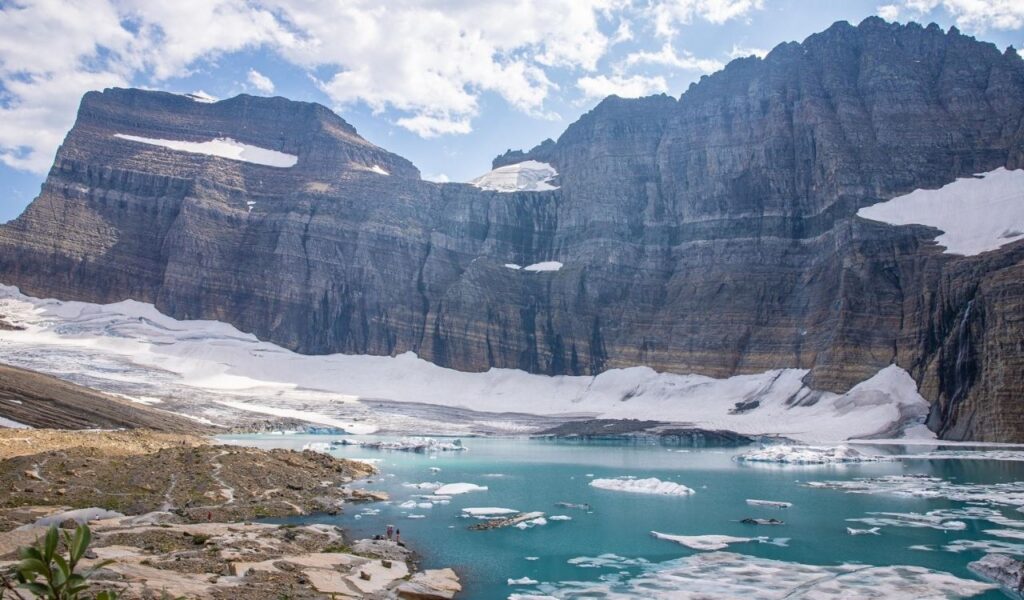
From the Grinnell Glacier Trailhead in Many Glacier, the Grinnell Glacier Viewpoint is about 5 miles one way with roughly 2,596 feet of elevation gain. NPS notes you can shorten the approach by reserving concessioner boat tickets that drop you 1.3 miles closer to the viewpoint, which can save time. This is active bear habitat, so carry bear spray, keep food sealed, hike in a group when possible, and call out on blind corners. Aim for late July through early September for the best odds of snow-free trail, and always check for temporary closures tied to wildlife or trail work.
5. Maroon Bells–Snowmass Four Pass Loop In Colorado
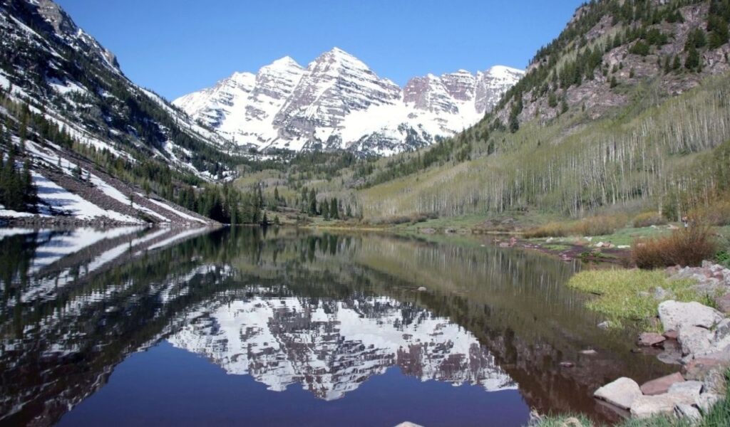
The Four Pass Loop is about 26 miles and crosses Buckskin, Trail Rider, Frigid Air, and West Maroon Pass, and tops out near 12,500 feet. Expect roughly 8,000 feet of total climbing across the loop, plus thin air and afternoon storms that can bring lightning. Overnight permit zones require reservation permits, and bear canisters are required for all backpackers. Most hikers target July through September when the snow is lower, and the trailheads are reachable. Start early to cross high passes before noon. Plan camps by permit zone, filter water, and add an acclimation day if coming from a low elevation.
6. Mount LeConte Via Alum Cave Trail in the Great Smoky Mountains
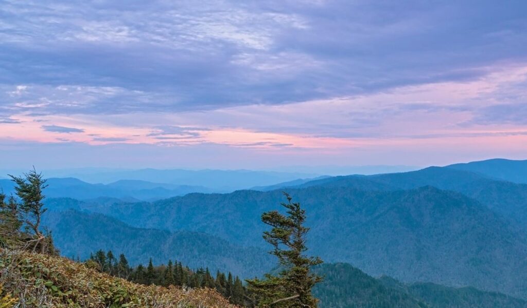
Alum Cave Trail to Mount LeConte is about 11 miles round trip with roughly 2,763 feet of elevation gain, one of the Smokies’ hardest day hikes. The route passes Arch Rock and the Alum Cave Bluffs before climbing to the LeConte area near the lodge, which is reached only on foot. Parking on Newfound Gap Road fills early, so arrive at dawn, carry rain gear for fast Smokies changes, and pack extra calories. Use trekking poles on the descent to reduce knee load, and expect damp rock and roots after storms, and do not count on cell service. Weekends are crowded in summer and fall.