Don’t Hit the Trails Until You Try These 6 Easy Hikes in the U.S. with Incredible Views
Skip the strenuous switchbacks and still earn a big payoff. These six U.S. hikes stay short and approachable, with clear trail surfaces and viewpoints that deliver national park-scale scenery. Distances and elevation are kept beginner-friendly, but each stop has a reason people plan around: a famous canyon rim, a river bend, hoodoo overlooks, a South Rim panorama, an alpine lake loop, and a Maine shoreline walk. Aim for early hours to beat crowds and heat where relevant.
1. Canyon Overlook Trail, Zion National Park, Utah
Canyon Overlook Trail is a 1-mile round-trip hike on Zion’s east side with roughly 150–200 feet of gain. The route uses carved steps and short slickrock sections, with railings along exposed edges, ending at a wide overlook above lower Zion Canyon. Parking is limited near the Zion–Mt. Carmel Tunnel, so arriving early matters. After rain, slickrock can feel slippery, and winter mornings can ice up, so shoes with grip help keep it easy. NPS notes the hike is short but includes drop-offs. Staying behind barriers is key. If the tunnel area is full, plan a pass later in the day when turnover improves, but avoid midday summer heat on the rock.
2. Horseshoe Bend Trail, Page, Arizona
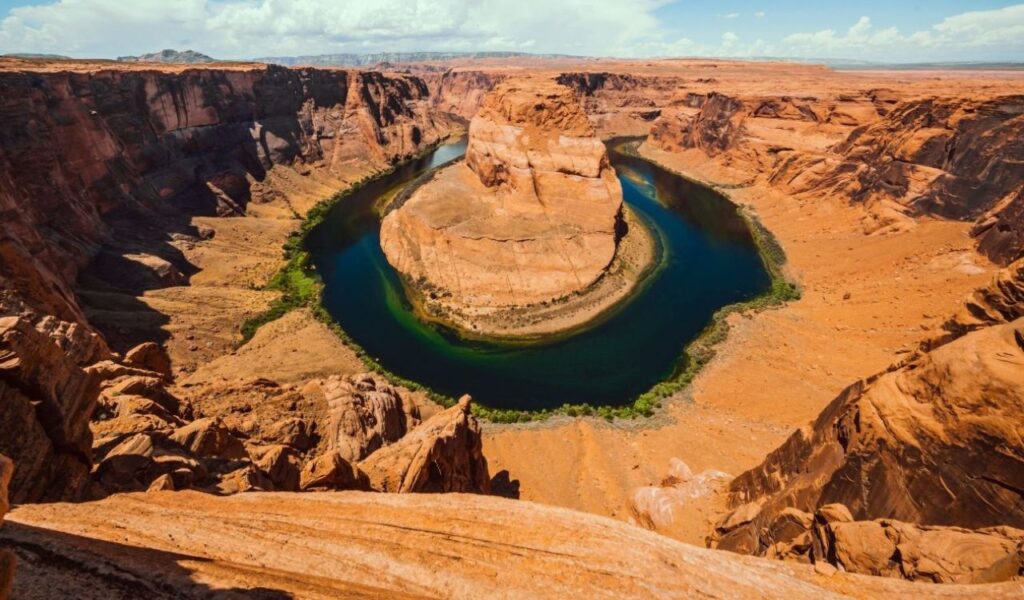
Horseshoe Bend is a 1.5-mile round-trip walk from the parking area to the Colorado River overlook near Page, Arizona. The path is wide and graded, with a gentle climb on the return, so the main risk is heat and sun. Carry water year-round and avoid midafternoon in summer. Railings cover parts of the rim, but some edges stay open, so keep kids close and step back before taking photos in the wind. Parking usually requires a fee, and sunrise is the calmest time. Expect little shade and gusts. After monsoon storms, sand can drift onto the path, and the rim can feel slick. If you visit at sunset, arrive early to park and find a viewing spot away from clusters.
3. Sunset Point To Sunrise Point Rim Trail, Bryce Canyon National Park, Utah
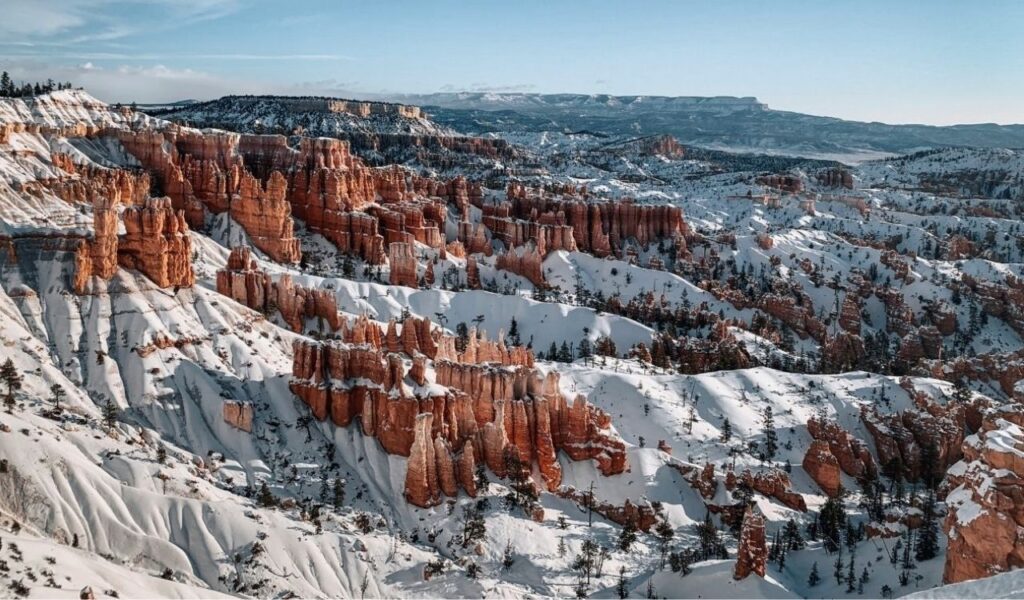
The Sunset Point to Sunrise Point walk follows Bryce Canyon’s Rim Trail on a paved, mostly level path. Going out and back is about 1 mile, with only small rolling grades, yet the viewpoints look into the main amphitheater of hoodoos. Morning is best because the air is cooler and the rock color reads clearly in photos. In winter, the rim can hold packed snow and ice, so traction devices help. Bryce sits above 8,000 feet, so even flat walking can feel harder. Stay on the rim path and behind fences, since the drop is immediate at overlooks. Restrooms sit at Sunset Point, and the park shuttle stops nearby in season, which reduces parking stress.
4. Mather Point Rim Walk, Grand Canyon National Park, Arizona
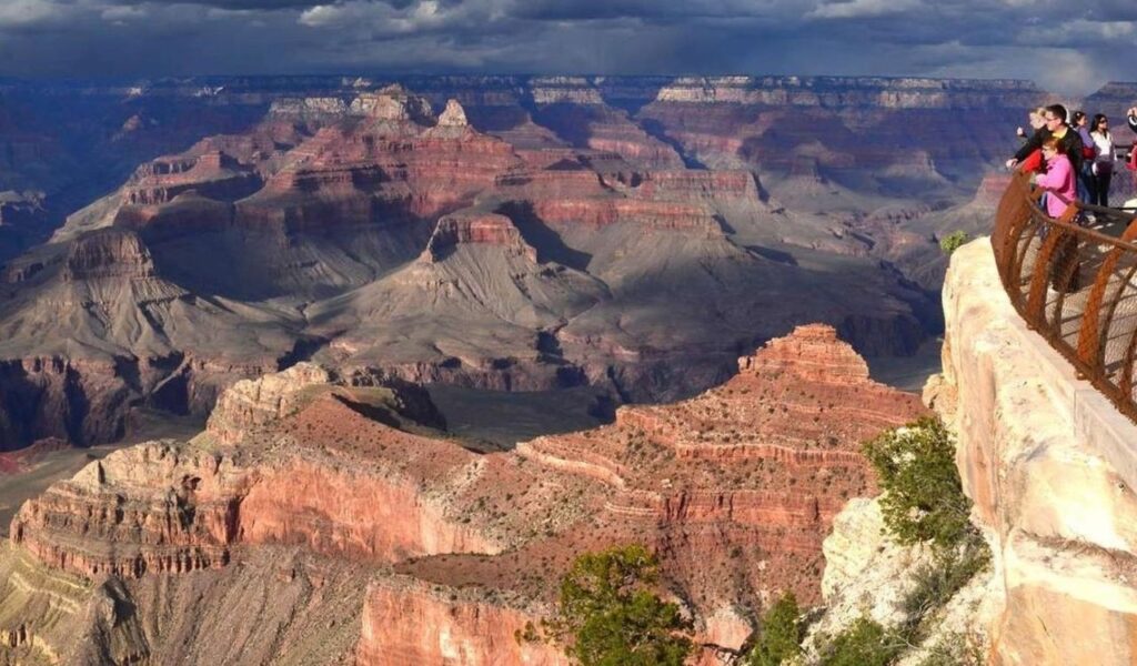
Mather Point sits near Grand Canyon Village and delivers a classic South Rim view with little walking. From the visitor center, paved paths reach the overlook in well under a mile round trip, and the grade stays gentle. The payoff is scale: layered rock walls, long sightlines, and often a visible ribbon of the Colorado River far below. The rim is over 6,000 feet, so pace matters for visitors arriving from low elevations. If parking fills, use the shuttle and keep to railings, especially after icy nights. Sunrise draws crowds, but late morning shows more detail once shadows lift. Wind can be strong, so secure hats and keep phones on straps.
5. Bear Lake Loop, Rocky Mountain National Park, Colorado
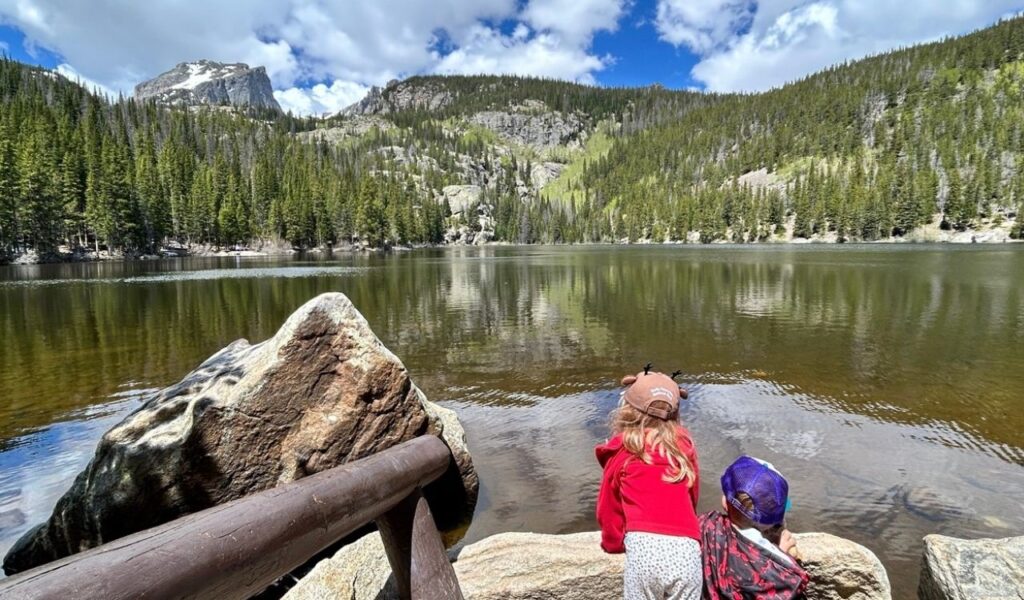
Bear Lake Loop is a 0.6-mile circuit in Rocky Mountain National Park with about 30 feet of elevation change. The trail is wide and maintained, with short boardwalk-style sections, making it one of the park’s easiest lake walks. Views include Hallett Peak and the Continental Divide rising above the water, especially sharp on calm mornings. Because the trailhead sits around 9,500 feet, some visitors feel the altitude sooner than expected. Arrive early in summer and fall, when parking and timed-entry demands are highest. Summer storms build fast, so finish before afternoon. In spring, snow can cover shady spots. Check park updates and bring layers.
6. Jordan Pond Path, Acadia National Park, Maine
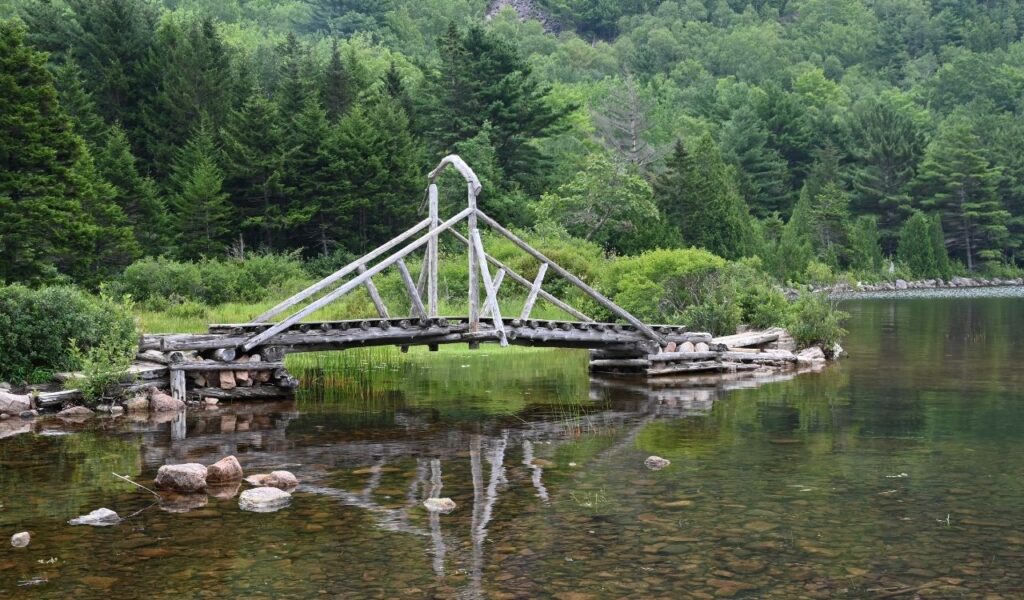
Jordan Pond Path in Acadia offers an easy shoreline walk with clear views of the Bubbles across the water. For the simplest option, follow the wide gravel path along the south and west sides for about 1 to 1.5 miles round trip, then turn back before the rock-hopping sections on the far shore. Elevation change is minimal, and the payoff stays constant: mountain profiles, clean water, and fall color later in the season. Parking near Jordan Pond fills fast, and black flies can peak in late spring, so start early and carry repellent. After rain, the shoreline can be muddy, and fog can lower visibility, so slow down near edges and keep to the gravel.