Adventure Awaits: 5 Must-Try Bucket-List Road Trips
A bucket list road trip should do more than look good on a feed.
It should put drivers on roads that test nerves a little, reveal hard-to-reach scenery, and
Pull them into viewpoints, trailheads, and diners that define a region.
In 2026, crowds, timed-entry rules at some parks, and weather swings make planning part of the adventure.
These five U.S. routes earn their reputation through iconic engineering, big geography, and seasons that change the experience.
1. Pacific Coast Highway, California
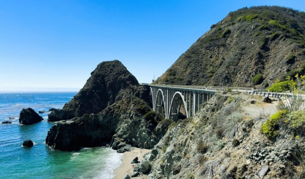
The Pacific Coast Highway is at its most intense between Monterey and San Simeon,
where Highway 1 rides cliffs above the Pacific, and the road can narrow after winter slides.
Big Sur pullouts near Bixby Creek Bridge reward early starts, before tour buses stack up.
Stop at Julia Pfeiffer Burns State Park for McWay Falls, then keep rolling past Ragged Point.
Fog can hide cyclists and turns, so daylight driving matters, and cell service drops in long stretches.
Top off fuel before entering Big Sur, because options are limited and pricey.
For steadier conditions and fewer slowdowns, many Californians pick late spring or early fall.
2. Going-To-The-Sun Road, Montana
Going-to-the-Sun Road cuts 50 miles across Glacier National Park and crests the Continental Divide
At Logan Pass, the road’s high point is at 6,646 feet.
Stone walls, short tunnels, and sheer drop-offs make the drive feel like a moving overlook.
Without stops, it takes about two hours, but most drivers need much longer once the viewpoints start calling.
Spring plowing tackles deep snowfields near the pass, allowing full opening dates to slide into late June.
Arrive at Logan Pass near sunrise to find parking, then take a short walk for alpine views and wildlife.
On the east side, sudden weather shifts and narrow lanes reward patient, low-speed driving.
3. Utah’s Mighty Five National Parks Loop
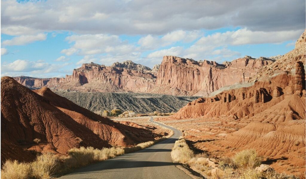
Utah’s Mighty 5 loop links Arches, Canyonlands, Capitol Reef, Bryce Canyon, and Zion in one road trip.
The reward is variety: slickrock fins near Moab, dark skies around Capitol Reef, and the cool rim air at Bryce.
Expect real elevation swings, plus two to four-hour drives between parks that look close on a map.
Summer heat can be brutal in the lower canyons, so shoulder seasons bring safer hiking and better light.
The state’s five parks drew more than 11.6 million visits in 2025, so popular trails can bottleneck fast.
Plan early starts, midday shade breaks, and a backup hike for crowded spots, especially in Zion.
4. Overseas Highway, Florida Keys
Florida’s Overseas Highway runs about 113 miles from the mainland to Key West, crossing 42 bridges
over open water.
The signature stretch is the Seven Mile Bridge, a 6.79-mile span that makes the ocean feel inches away.
As part of U.S. 1, it strings together old fishing towns, marinas, and seafood shacks, not just postcard views.
Wind and glare can fatigue drivers, so sunglasses, water, and short stops matter more than on inland routes.
Snorkel access in Islamorada and sand at Bahia Honda State Park turn the drive into a day-by-day coastline plan.
Winter and early spring usually offer calmer weather outside peak hurricane risk.
5. Denali Highway, Alaska
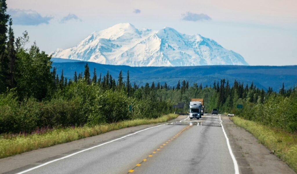
Alaska’s Denali Highway (Route 8) runs 135 miles between Paxson and Cantwell and stays mostly gravel,
which keeps traffic low and the scenery big.
It was once the first road access to Denali National Park, and it still feels like Alaska wilderness travel.
Surface conditions change fast; speeds sit near 35 to 55 mph, so the day runs longer than expected.
Services are scarce, cell coverage is unreliable, and potholes appear after rain, so a spare tire helps.
The route closes for winter from October into mid-May, making late summer the safest window.
On clear days, tundra valleys open to distant peaks, and wildlife sightings are common.